Pennine Software Sea State Page
Information useful for sea kayakers and others in small vessels. The north Atlantic charts linked here give the best insight into British waters - if you are having a holiday in the sun, you can find a variety of charts for the Mediterranean and elsewhere via westwind.
| The latest NOAA/NCEP N. Atlantic wave model hindcasts: | ||
|---|---|---|
| 10m wind speed/direction | Significant wave height & peak direction |
Wave period & direction |
 |
 |
 |
NOAA also provide forecasts for the same area. These were generally available 5 hours 45 minutes after the time of the data from which they are forecasted (plus or minus half an hour - it was very rare that they are up to an hour late). So if it is 9 a.m. in the UK, you should expect the times below to be offsets from midnight UTC just gone...
However, recently I have noticed a lack of updates, and stuff seems to be appearing up to a day late - so check the start times on the images above and work forward from that time to deduce which forecast you want from the left hand table. I've recently discovered the meteosim forecasts (right hand table) which may update more promptly (not enough experience of them yet), but only go 72 hours ahead:
|
| ||||||||||||||||||||||||||||||||||||||||||||||||||||||||||||||||||||||
More wave charts (height, direction, dominant period).
Wave/seastate forecast for North Shields (runs four days from 00:00Z in three hour intervals)
Free Surf forecasts for NE England
Scotland
Other areas (nothing for Irish Sea)
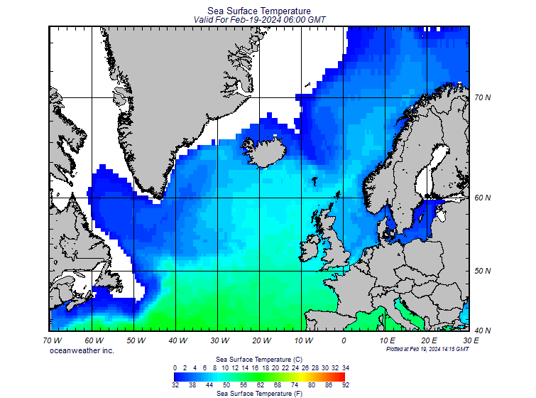
North Atlantic sea surface temperature, from Oceanweather
Sea surface temperatures across the NE Atlantic and North Sea, from the UK Met Office
More sea surface stuff inc. links to big global views. Use the NCEP/NOAA one, the fnmoc one is no longer public and you get an out-of-date image.